Open Lidar Data Announcement
Throughout 2024, some of ABMI's lidar data will be made freely and publicly available on our website.
March 2024
In 2022 the Alberta Biodiversity Monitoring Institute (ABMI), in partnership with various funders and collaborators, began collecting lidar data across Alberta, and beyond. Throughout 2024, some of these lidar data — covering approximately 5,600 km2 — will be made freely and publicly available on our website.
What is lidar?
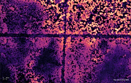
Lidar stands for light detection and ranging, and here's how it works: A scanner (laser transmitter and receiver), a global navigation satellite system (GNSS) receiver and an inertial navigation system (INS) are mounted to an aircraft. A laser is sent towards the ground by the scanner and is reflected back from various surfaces. The distance the laser beam travelled is measured based on the time it takes to get back to the scanner. When that information is combined with the positional information from the GNSS and INS, we can create three-dimensional point clouds that represent the surface.
Read more about lidar here.
About the ABMI’s lidar program
We've collected nearly 70,000 km2 of lidar data to date. Our goal is to make these high-quality, wide-area datasets freely available and accessible to benefit researchers, land managers, Indigenous communities, policymakers, and the broader community.
During the growing season (June 15 – September 15), we typically collect data at a density of 12 points per m2. In the spring and fall (“leaf off”), data collection usually yields a density of 6 points per m2.
Beyond data collection, we run several applied programs that leverage these lidar datasets, such as tracking habitat in Alberta's caribou ranges.
What type of data will be available?
Field-based ground truthing data and the following standard lidar derivative products, with associated metadata, will be made available for download:
- Bare Earth Digital Elevation Model (DEM)
- Canopy Cover
- Canopy Height
- Tree Tops
- Roughness
- Mean Intensity of Return
- Mean Height of Vegetation
- And others
Which lidar datasets will be available?
Throughout 2024, lidar data covering approximately 5,600 km2 will be made publicly available on our website (see map below). These datasets encompass the following locations:
- Christina Lake, Alberta (flown 2022, approx. 3,000 km2)
- Porcupine Hills, Alberta (flown 2022, approx. 1,000 km2)
- Perimeter Forest Project, British Columbia (flown 2023, approx. 1,600 km2)
An additional 38,000 km2 will be publicly released throughout 2024 and 2025.
The Christina Lake and Porcupine Hills datasets were collected with funding support from the Government of Alberta while the Perimeter Forest Project block was collected with funding support from Perimeter Forest.
Planned lidar missions (summer of 2024)
During the summer of 2024, we are planning to fly new missions covering approximately 30,000 km2 (see ‘Committed Missions’ in map). A detailed schedule of public release of this lidar data will be communicated as the season progresses.
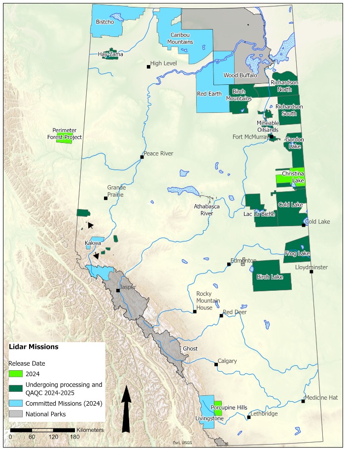
Figure 1. Over 43,600 km2 of lidar data that will become publicly available in 2024 and 2025 (green) with approx. 5,600 km2 available in 2024. Also shown are new 2024 lidar acquisition missions planned (Committed Missions).
Learn more about the lidar program
For more information about the lidar program, please contact us at abmidata@ualberta.ca.
Subscribe to our revamped Data Digest (formerly Data & Analytics Portal updates) and never miss a release! These quarterly emails will provide a summary of new datasets available—including lidar, human footprint, and ABMI field data—and how to access and use the data.
Working with the ABMI
We are happy to work in a collaborative and supportive environment. For inquiries regarding lidar acquisition or its applications please reach out to Murdoch Taylor (murdoch.taylor@ualberta.ca).