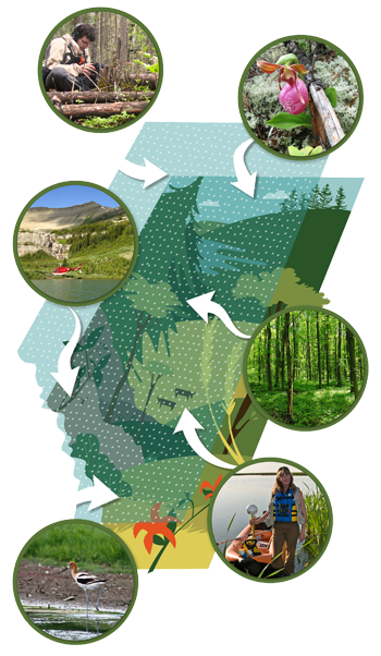
ABMI Measures Biodiversity
From the boreal forest in the north to the grasslands in the south, the ABMI monitors the state of Alberta’s biodiversity. To do this, the ABMI employs a systematic grid of 1,656 site locations, spaced 20 km apart, to collect biodiversity information on terrestrial and wetland sites.
At each location, ABMI technicians record the species that are present and measure a variety of habitat characteristics. For species that cannot be identified in the field (e.g., mites and lichen), ABMI taxonomists located at the Royal Alberta Museum sort, identify, and archive samples to complete the Institute’s species-level dataset. Through our field and laboratory efforts, the ABMI tracks over 2,500 species.
ABMI Measures Human Footprint
The ABMI also monitors the state of Alberta’s Human Footprint (HF). The ABMI Geospatial Centre creates and updates HF information using high resolution remotely sensed imagery (e.g., 1.5m Colourmerge product of the Satellite Pour l’Observation de la Terre (SPOT6)) as a backdrop to visually interpret and manually digitize anthropogenic disturbances on the land surface, as well as orthorectified mosaic images created from aerial photographs as a visual validation reference when needed.
The ABMI produces HF information at provincial and sample-based spatial scales:
- The provincial scale or wall-to-wall Human Footprint Inventory (HFI) is created on a two-year update cycle and are available for years 2007, 2010, 2012, and 2014, with the 2016 HFI currently in production.
- At the sample-based scale, the ABMI produces several datasets. The most widely utilized is the 3x7 km HF time-series dataset, available 1999-2016. In this dataset, each HF feature detected in satellite imagery is mapped for a grid of 1,656 3x7 km permanent sample sites evenly spaced 20 km apart across Alberta, covering approximately 5% of the province. Other sample-based HF datasets include delineation of HF features within the ABMI’s terrestrial and wetland sites.
Regardless of the scale used for mapping, the ABMI divides all HF features into 115 feature types which are then classified into 21 sublayers and six categories associated with energy, forestry, agriculture, residential and industrial, human-created waterbodies, and transportation for analysis and reporting. These mapped products are updated at regular intervals to track changes in human footprint and habitat over time and identify relationships between human land use, habitat, and species abundance when and where they exist.
A Unique Program
The scale and depth of the ABMI’s monitoring program described above make it a unique program nationally, and a leader internationally.
Members of the ABMI’s Science Advisory Committee (an external review board) describe the ABMI as “one of the premier monitoring programs in the world” (Dr. Reed Noss of the University of Central Florida) and “leading the biodiversity monitoring charge in Canada” (Dr. Jeremy Kerr of the University of Ottawa).